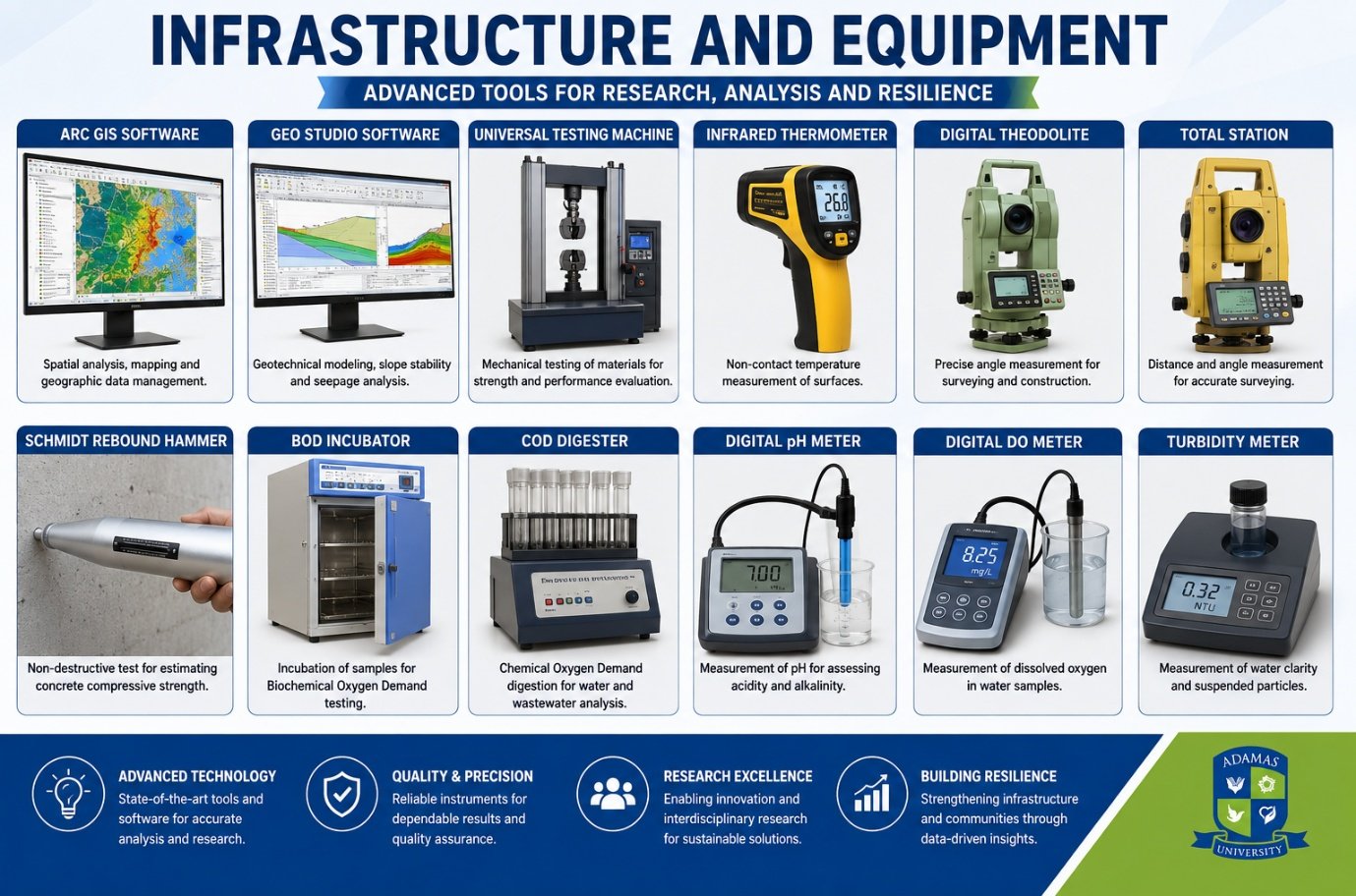
Our centre is equipped with cutting-edge instruments and software that enable comprehensive disaster studies, geotechnical analysis, structural assessment, and environmental monitoring.
Spatial analysis, mapping and geographic data management for disaster-prone area identification.
Geotechnical modeling, slope stability and seepage analysis for landslide risk assessment.
Mechanical testing of materials for strength and performance evaluation in structural resilience studies.
Non-contact temperature measurement of surfaces for post-disaster structural assessment.
Precise angle measurement for surveying and construction in disaster-affected zones.
Distance and angle measurement for accurate surveying and terrain mapping.
Non-destructive test for estimating concrete compressive strength in damaged structures.
Incubation of samples for Biochemical Oxygen Demand testing in flood-affected water quality analysis.
Chemical Oxygen Demand digestion for water and wastewater analysis in post-disaster scenarios.
Measurement of pH for assessing acidity and alkalinity of water samples from disaster sites.
Measurement of dissolved oxygen in water samples for environmental impact assessment.
Measurement of water clarity and suspended particles in disaster-affected water bodies.
State-of-the-art tools and software for accurate analysis and research.
Reliable instruments for dependable results and quality assurance.
Enabling innovation and interdisciplinary research for sustainable solutions.
Strengthening infrastructure and communities through data-driven insights.
Explore collaboration opportunities and learn how our infrastructure supports cutting-edge disaster research.
Get in Touch